Log in
All resources
Create a design
2,089 Free Artworks of Atlas Of France
bibliothèque nationale de france
victor levasseur - maps of france
fonds ancely - bibliothèque municipale de toulouse - maps
steel engraving print
bibliothèques de toulouse
atlante geografico del regno di napoli (1812)
raymond bonheur
atlas, ou représentation du monde universel et des parties d'icelui, faicte en tables et descriptions très amples et exactes, divisé en deux tomes. édition nouvelle... - btv1b53103889w
academic art
life of jesus christ, window, chartres
atlante geografico del regno di napoli (1812)
bibliothèque nationale de france
atlante geografico del regno di napoli (1812)
bibliothèque nationale de france
atlante geografico del regno di napoli (1812)
bibliothèque nationale de france
atlante geografico del regno di napoli (1812)
bibliothèque nationale de france
atlante geografico del regno di napoli (1812)
bibliothèque nationale de france
atlante geografico del regno di napoli (1812)
bibliothèque nationale de france
atlante geografico del regno di napoli (1812)
bibliothèque nationale de france
atlante geografico del regno di napoli (1812)
bibliothèque nationale de france
atlante geografico del regno di napoli (1812)
bibliothèque nationale de france
atlante geografico del regno di napoli (1812)
bibliothèque nationale de france
atlante geografico del regno di napoli (1812)
bibliothèque nationale de france
atlante geografico del regno di napoli (1812)
bibliothèque nationale de france
atlante geografico del regno di napoli (1812)
bibliothèque nationale de france
atlante geografico del regno di napoli (1812)
bibliothèque nationale de france
atlante geografico del regno di napoli (1812)
bibliothèque nationale de france
atlante geografico del regno di napoli (1812)
bibliothèque nationale de france
atlante geografico del regno di napoli (1812)
bibliothèque nationale de france
atlante geografico del regno di napoli (1812)
bibliothèque nationale de france
atlante geografico del regno di napoli (1812)
bibliothèque nationale de france
atlante geografico del regno di napoli (1812)
bibliothèque nationale de france
atlante geografico del regno di napoli (1812)
bibliothèque nationale de france
atlante geografico del regno di napoli (1812)
bibliothèque nationale de france
atlante geografico del regno di napoli (1812)
bibliothèque nationale de france
maps showing history of the early middle ages
charles the bald
coats of arms of cities in oise
pierre de la ramée
atlas - voyage pittoresque à l'île-de-france, au cap de bonne-espérance et à l'île de ténériffe (1812) by milbert
cape town in the 1800s
old maps of pyrénées-orientales
1852 maps of france
old maps of guizhou
maps from gallica
atlante geografico del regno di napoli (1812)
old maps of ariano irpino
atlas - voyage pittoresque à l'île-de-france, au cap de bonne-espérance et à l'île de ténériffe (1812) by milbert
tenerife in the 1800s
atlas, ou représentation du monde universel et des parties d'icelui, faicte en tables et descriptions très amples et exactes, divisé en deux tomes. édition nouvelle... - btv1b53103889w
maps of the peloponnese by gerardus mercator
atlas, ou représentation du monde universel et des parties d'icelui, faicte en tables et descriptions très amples et exactes, divisé en deux tomes. édition nouvelle... - btv1b53103889w
17th-century maps of silesia
atlas, ou représentation du monde universel et des parties d'icelui, faicte en tables et descriptions très amples et exactes, divisé en deux tomes. édition nouvelle... - btv1b53103889w
maps of guinea by mercator-hondius
atlas, ou représentation du monde universel et des parties d'icelui, faicte en tables et descriptions très amples et exactes, divisé en deux tomes. édition nouvelle... - btv1b53103889w
maps of candia by ortelius and mercator
atlas, ou représentation du monde universel et des parties d'icelui, faicte en tables et descriptions très amples et exactes, divisé en deux tomes. édition nouvelle... - btv1b53103889w
17th-century maps of chile
atlas, ou représentation du monde universel et des parties d'icelui, faicte en tables et descriptions très amples et exactes, divisé en deux tomes. édition nouvelle... - btv1b53103889w
maps of waldeck by gerardus mercator
bibliothèque nationale de france
maps by thomas kitchin
victor levasseur - maps of france
19th-century maps of finistère
horse riding in engravings
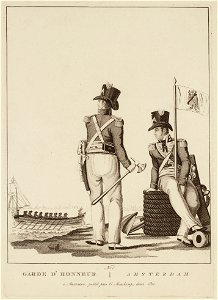
evert maaskamp
atlas - voyage pittoresque à l'île-de-france, au cap de bonne-espérance et à l'île de ténériffe (1812) by milbert
cape town in the 1800s
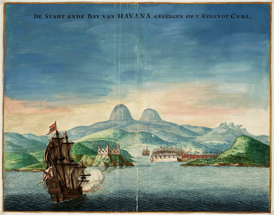
old maps of havana
1665 maps
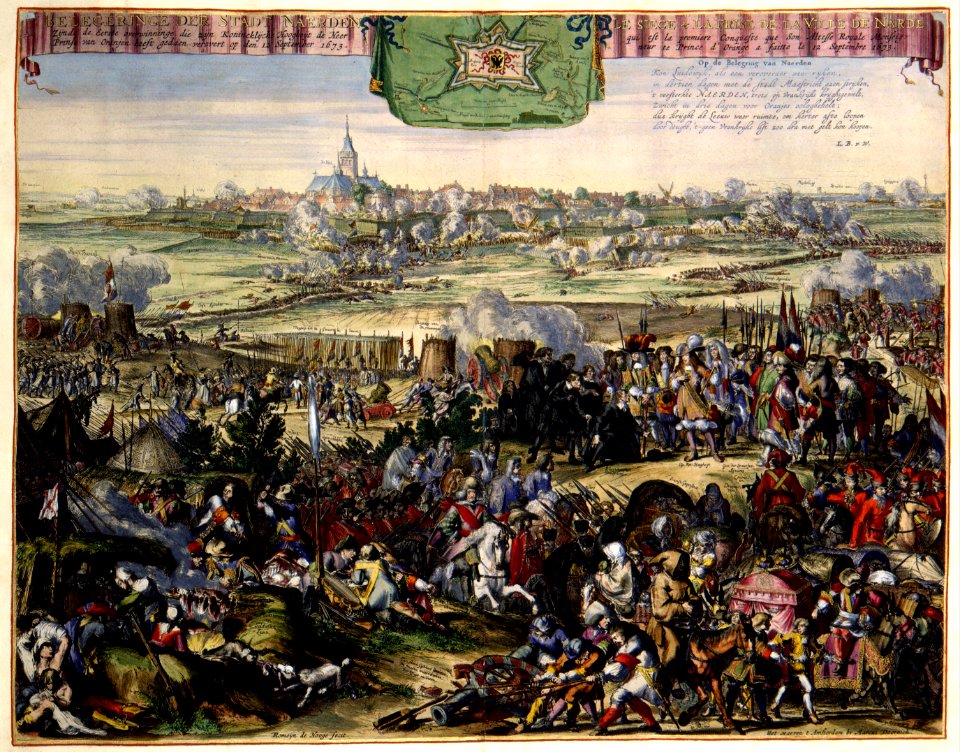
atlas van der hagen (volume 2)
atlas van der hagen
maps by pieter mortier
le neptune francois
le neptune francois
pierre lepautre
bibliothèque nationale de france
novus atlas sinensis
collectie atlas dreesmann
evert maaskamp
cpb-scan from france
academic art
cpb-scan from france
academic art
ornithorhynchus anatinus (illustrations)
works after charles alexandre lesueur
atlas van der hagen (volume 2)
atlas van der hagen
atlas van der hagen
baroque
maps of paris from the david rumsey historical map collection
maps of paris by caspar merian
19th-century maps of france
1854 maps of france
atlas - voyage pittoresque à l'île-de-france, au cap de bonne-espérance et à l'île de ténériffe (1812) by milbert
cape town in the 1800s
14th-century illuminated manuscripts from spain
jong (ship)
maps in the british museum
taddeo crivelli
maps of south america by mercator-hondius
bibliothèque nationale de france
giuseppe angeli
baroque
romanticism,neoclassicism
1852 maps of france
cpb-scan from france
academic art
coats of arms of cities in nièvre
andré dupin
coats of arms of mézières (ardennes)
victor levasseur - maps of france
18th-century maps of korea
nouvel atlas de la chine
history of avignon
atlas van loon
life of jesus christ, window, chartres
academic art
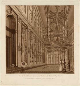
royal palace of amsterdam interiors
evert maaskamp
coats of arms of rhône
old maps of rhône
cpb-scan from france
academic art
cpb-scan from france
academic art
coats of arms of cities in haute-marne
charles-guillaume étienne
victor levasseur - maps of france
coats of arms of perpignan
coats of arms of cities in var
19th-century maps of var
old maps of regions of france
pierre françois tardieu
maps of paris from the david rumsey historical map collection
1774 in paris
19th-century maps of seine-et-marne
coats of arms of seine-et-marne
coats of arms of cities in haute-loire
marquis de lafayette in art
georges-louis leclerc, comte de buffon
coats of arms of dijon
coats of arms of auch
old maps of gers
coats of arms of cities in doubs
bon adrien jeannot de moncey
coats of arms of cities in vaucluse
jean-sifrein maury
victor levasseur - maps of france
engravings by nicolas mignard
coats of arms of cities in ardèche
victor levasseur - maps of france
coats of arms of orléans
gaspard de coligny
coats of arms of cities in drôme
jean étienne championnet
19th-century maps of haute-saône
coats of arms of vesoul
victor levasseur - maps of france
old maps of gironde
19th-century maps of loire-atlantique
pierre cambronne
pierre terrail de bayard
casimir pierre perier
19th-century maps of loire (department)
coats of arms of cities in loire
turgot map of paris, norman b. leventhal map center
sheet 19 of the turgot map of paris
bibliothèque nationale de france
félix robaut
west-indische compagnie
1665
maps by john cary
1799 maps
1800s maps of the iberian peninsula
maps by john cary
coats of arms of cities in lot-et-garonne
victor levasseur - maps of france
19th century maps of haute-vienne
coats of arms of haute-vienne
coats of arms of nîmes
baroque
coats of arms of chalon-sur-saône
alphonse de lamartine
coats of arms of saint-brieuc
old maps of côtes-d'armor
19th-century maps of indre-et-loire
coats of arms of tours
1701 - 1800 of 2,089
Next page
/ 21